What We Do

Surveying & Geodesy

Taking a project from concept to reality hinges on quality of surveying data, and MicroCenter has been delivering reputable surveying and Geodetic survey services for the Engineering, Infrastructure, Construction, Industries and other essential facilities within Bahrain & Saudi Arabia for more than 25 years. We are a multidisciplinary team of surveying professionals and Licensed Geodetic engineers who stand ready to support your land project with state-of-the-art technology, regulatory support, and service excellence.

Surveying & Geodetic survey- Services
  • Conventional Surveying- Pre and Post Engineering & construction surveying
  • Land surveying
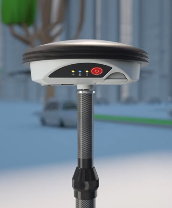
  • GNSS RTK Data acquisition, Ground control network, Loop Levelling & Monumentation
  • Geodetic surveying
  • Topographic surveying & Elevation Data
  • Manhole invert Measurements
  • As-build
3d Laser Scanning

MicroCenter utilizes the latest technological advances in Topographic & Utility data gathering and transmission. Combining time-honoured land surveying methods with the latest 3D Laser scanning Technology and satellite technology, we produce PRECISE results that meet technical specifications while satisfying our clients. Survey results are delivered on the latest CAD standard and in GIS format, so clients with advanced software can make use of the data immediately.

What We Offer
  • Topographic survey & Planimetric detailing through 3D Laser scanning
  • Indoor Scanning and as-build through 3D Laser scanning
  • 3D scanning for Industrial, commercial & Hospital- Land, Building, Infrastructure, Assets, machinery, MEP, Structure
  • 3D modelling, Simulations and virtual reality
  • 360-degree reality capture and virtual reality modelling of the property for the Lease management
  • Façades inspection: 3D dimensional inspection of building
  • As-build documentation and Change detection
  • Volumetric calculations- Dimensional calculations

Underground Utilities Scanning & Mapping- Advantages

Drawing from many years of underground utility locating experience, MicroCenter has achieved a unique industry position and expertise in the areas of Ground Penetrating Radar Technology. MicroCenter make use of the most advanced GPR technology and equipment’s to produce in-depth and precise utilities asbuild / mapping results in 2D & 3D with VR /AI experience.

What we Offer
  • In-depth scanning for the Underground utilities, Cables, Structures, Buried Assets; for the depth penetration up to 10 meter below ground level, using 3D Ground Penetrating Radar and Electromagnetic locator system
  • Identification of Metallic and Non-Metallic pipes and their sub-types, Plastic/PVC Pipes, HV/LV Cables, Optical Fiber, and of other material
  • Differentiation on the Type of Utilities, Depth of the Utilities, Location of the Utilities, and other attribute information
  • In-depth details of the underground features like Buried structures, Ducts, Valves, buried utilities & Pipes, joints, possible water leakage identification, and last but not the least identification of non-revenue water
  • Manhole investigation & Invert measurements
  • Structural imaging and Concrete Scanner-Radar Imaging
  • As-build and network drawing creation- 2D & 3D
BIM (Building Information Modeling) | VDC (Virtual Design and Construction) Advanced technology consulting solutions
Our Services Let You Plan, model, Implement BIM to your project.
What We Offer
  • BIM, VDC, Prefab, and construction tech adoption & consulting
  • VDC & BIM Coordination
  • BIM Content Creation
  • Migrating from CAD to BIM
  • Laser Scanning- Scan to BIM and As-builds
  • Architectural and Structural BIM Modelling
  • 4D Construction Sequencing & 5D Cost Planning
  • MEP Modeling with isometric/section view and annotations
  • Coordination & Clash detection
  • 3D Mechanical Modeling of HVAC, fitting, equipment, diffusers, grills, etc.
  • 3D Electrical Modeling of the fixtures. Rendering with lights.
  • 3D Plumbing Modeling
  • Construction Progress Tracking and Verification
  • 3D Modelling & Visualization- AR and VR Solutions
  • Renovation/refurbishment, retrofit or reconstruction projects
  • integrated 3D BIM model
  • AEC Innovation/Software Development services
  • GeoBIM / BIM Training

Bathymetric Survey And Marine Survey Advantage

MicroCenter performs Bathymetric survey to map sea bed profile along the Bahrain and Saudi Coast. Bathymetric survey data is gathered using a single-beam or Multibeam echo sounder, profiler and probe and processed using -PDS 2000 or Hypack navigation & survey software -CARIS and other processing software.

  • High resolution bathymetry of the seafloor
  • Sonar Imagery- Sonar survey is the provision of seabed imagery for seabed nature characterization as well as obstruction detection and identification
  • Shallow water Sub-Bottom Profiling
  • Anchor Block- Marine (on-water) survey services to identify locations and help with positioning of Concrete anchor blocks underwater
  • Cable and pipeline route investigation
  • Data Management and GIS
About MicroCenter Group

Established in 1983, MicroCenter(MCG) Bahrain is a full-service Surveying and Geospatial Technology company, offering broad variety of specialized and innovative services in areas such as -Geospatial Information system (GIS) – Product and Solutions , Surveying & Geodetic Survey-Services and Solutions, 3D Lidar & Radar, Underground Utilities, Structural scanning and asbuild, BIM & VDC adoption & consulting, 3D modelling & Simulation- Virtual Reality, Bathymetric and Marine Survey, International Education & Training –Esri & Autodesk, Enterprise planning products(ERP) and Solutions, ICT & IOT - Services & Solutions, Solar Energy-Products & Solutions.

Over the years, MicroCenter (MCG) has provided Multi-Disciplinary Services and Solutions to the clients, from GIS Applications, LiDar, Radar, Aerial, Satellite and UAV imageries, Topographic, Planimetric and Utilities mapping and IOT Products and applications; for the projects across areas such as Government & Ministries, Infrastructure, Engineering, Construction, Utilities & Power, Defence, Airports, Sea ports, Industries, Hospitals, Environment, etc.; within the Kingdom of Bahrain & across Kingdom of Saudi Arabia, Middle East and North Africa.

MicroCenter offers a unique range of capabilities from Esri ArcGIS products & implementation, Infrastructure Modernization and Cloud Computing to Big Data Analytics, and the Development of Software and Web-based Visualization Platforms.

MicroCenter is sole Esri Authorized Learning Center, Autodesk Training Center and Autodesk Academic Partner. MicroCenter offers a comprehensive suite of training options in Esri ArcGIS, Geodatabases, Utility Management, Autodesk & Revit, GeoBIM & BIM, Geodetic Surveying, LiDar, App development, Mobile app – Games & Entertainment and Robotic.

MicroCenter IOT/ICT solutions comprises of the prime enterprise products MCA e-biz and Visitor management system that are built in-house, Digital Card solutions and serving successfully at and for the large client base within Bahrain.

Project Success

MicroCenter performs Bathymetric survey to map sea bed profile along the Bahrain and Saudi Coast. Bathymetric survey data is gathered using a single-beam or Multibeam echo sounder, profiler and probe and processed using -PDS 2000 or Hypack navigation & survey software -CARIS and other processing software.

  • Geodetic survey: GNSS Data acquisition and establish ground control network at seven (7) large mapping projects.
  • Surveying, Topographic mapping for large area, Close to 1.27 million square meters
  • Topographic survey: Topographic survey for over 1.75 million square meters’ area within Bahrain & Saudi Arabia, via the 3D LiDar scanning Technology
  • Underground Utility Locating: Performed detailed scanning for over 4 million square meters’ area using 2D / 3D Ground Penetrating Radar-GPR Technology; to locate and map Underground utilities within Bahrain & Saudi Arabia.
  • Utility surveying and GIS Databases project for EWA, ever since last 8 years and work on-going.
  • Structural Scanning: Structural scanning using Radar scanning technology to detect structures and power cables
  • Manhole Investigation: Manhole invert level measurements, butterfly for seven (7) large Topo & Utilities mapping projects.
  • Building Information Modelling-BIM - Lidar Scan-BIM project for six (6) major hotel canopy in Bahrain and BIM modelling & 2D asbuild for the canopy Structures & its Geometric measurements, BIM MEP and BIM Architecture for the buildings in Riyadh, Saudi Arabia.
  • Esri ArcGIS Enterprise solutions and services: Serviced 90% of the Ministries and Government within Kingdom of Bahrain for the GIS solutions and Databases.